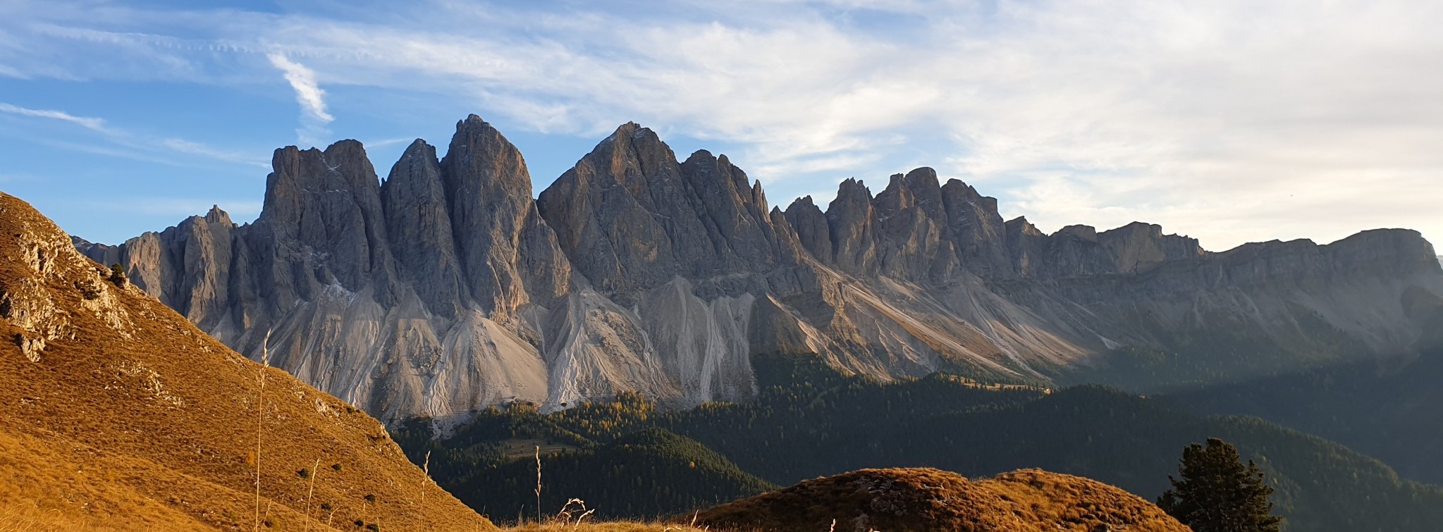
When working in extreme environments having advance knowledge of the weather conditions can be the difference between a successful operation or a waste of time and resources with considerable personnel risk. Whether it is a mountain survey, fieldwork, an environmental assessment or a mining operation, lacking a good forecast can be an extremely risky business.
Weather forecasts are not perfect, but they have become impressively accurate in recent years. However there is an oversupply of information in this field, with little quality controls in most cases. If your work is affected by weather and you work at high altitude or in a tough environment, there is one key aspect of the weather information to consider: the model spatial resolution.
There are quality global data coming from models such as the GFS or ECMWF, but it is necessary to know their limitations, as they are not applicable everywhere, every time. Because these models are global, there is an intrinsic limitation to their resolution, typically between half and 0.25 degrees of latitude and longitude. This is good to get a general picture, but it may miscalculate local conditions by a large margin.
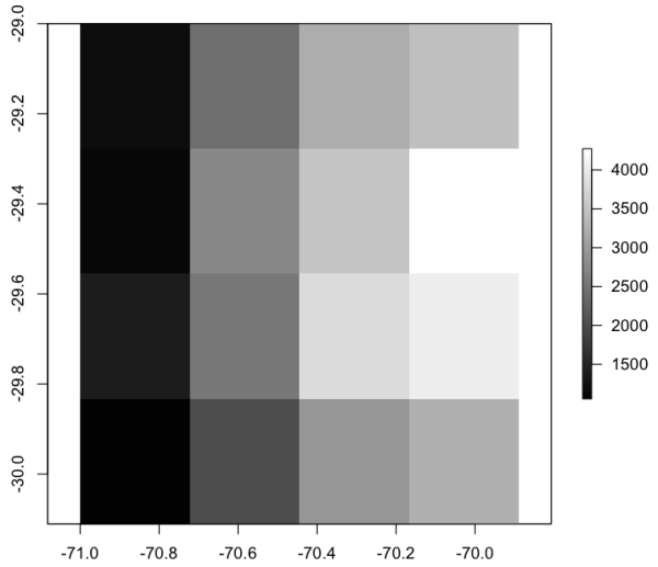
To illustrate this point, a mountain transect as viewed by different models may be useful. Figure 1 is an east-west transect across the Andes mountains as seeing by the 0.50° resolution GFS model and by the WRF model at 4km resolution.
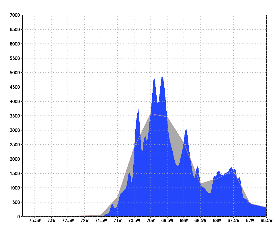
The most striking difference is that the highest mountains are one kilometre lower in the GFS than the WRF. This has an impact in the performance of the model, affecting winds, precipitation and temperature. It is also evident that for one model the mountains are rounded with no peaks and valleys, while the other model can simulate the topography much better. This has an impact on wind drag, solar radiation, rain shadow, enhanced precipitation, etc., etc.
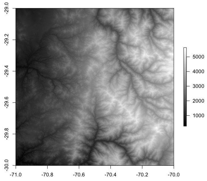
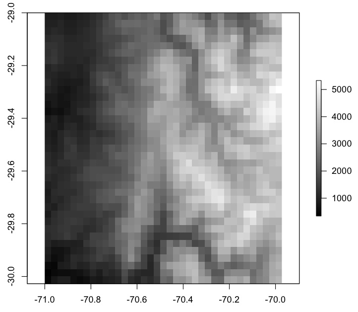
In Figure 2 a) to c) the differences are shown for a large area. Figure a) is a digital elevation model at 30 m resolution, where ridges (white) and valleys (dark) are clearly visible, in b), at 3 km resolution, the general structure is visible although fine details are lost, in c) the actual details of the mountain relief are gone.
|
a) 30 m |
b) 3 km |
|
c) 30 km |
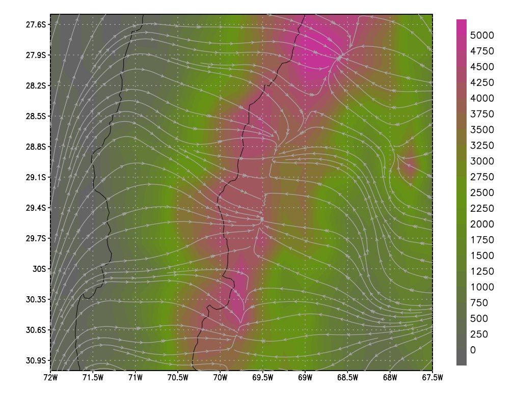
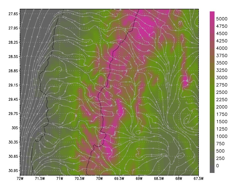
The effect on wind velocity and direction are quite clear, while the GFS winds will flow smoothly over the Andes, the WRF winds are channelled through valleys in a way that is much more realistic, as shown in Figure 3.
|
a) 0.25° resolution |
b) 4 km resolution |
If your activity is affected by strong winds or you have operations and infrastructure on exposed ground, the low-resolution model is not very helpful. If the operation has an environmental impact, such as dust or pollutant dispersion or if there is a risk to personnel, then the high-resolution model is the only recommendable. It can help reducing risk, reducing cost by minimizing potential damage and it will increase personnel safety.
We have put a demo page for a site at high altitude on the Arid Andes at htps://meteoexploration.com/pro/demo/mapindex.php it contains data from the GFS model at 0.25 resolution and the WRF at 4 km resolution, feel free to explore it and identify the differences between both models.
Notes:
DEM: Digital Elevation Model, is a mathematical representation of the terrain as a matrix of elevation values.
GFS: Global Forecast System, is a global numerical weather forecasts produced by the NCEP/NOAA.
WRF: Weather Research and Forecasting, is a mesoscale weather model which can be run at higher resolution than the global models.
Pingback: Pronóstico del viento y generación eólica – meteoexploration